- Sunrise Point (Ganek View Point):
It is located 6 km away from Zuluk and stands at a height of 10,600 feet on the Silk Route. To visit the Ganek View Point you have to reach the spot by 4:30. The red sun rising in the Eastern skies with its colour coating Mount Kanchenjunga at a distance is a beauty to behold. You have to see it to believe it. One can also see the Bhutan Plains from his view point and event the Pangolakha Wildlife Sanctuary.
- Nag Temple:
This temple is actually a cave and the idol inside it has been naturally formed by cracks in the rocks. It resembles the shape of a giant king cobra (nag) and hence, the name of the temple. The locals have devoted the shrine to Nag Devta in Hindu mythology.
- Thambi View Point:
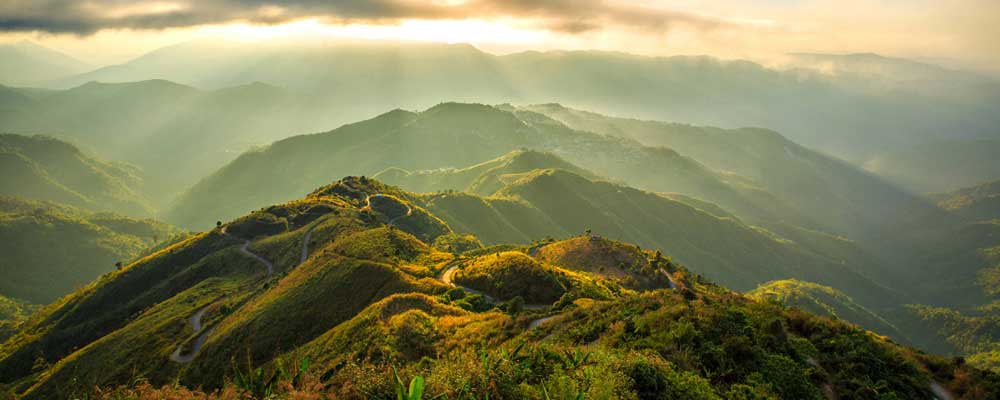
Another viewpoint in your itinerary, the Thambi View Point in Zuluk lies at an altitude of 11,200 feet. From here, you can have a terrific view of the ZigZag road, i.e the Old Silk Route. If there’s snow, you will get to witness a view that’s beyond amazing. The Thambi View Point will arrive almost immediately as you leave Dzuluk and drive uphill. Ask you driver to take you to the ‘Yeti point’ on the way – a place where the locals reportedly spotted a Yeti once.
- Lungthung:
It is also known as Dhupidara and rests at a height of 12,500 feet. Lungthung is 4 km away from the Thambi View Point. At this point, you will not be riding uphill. Instead, you will be driving over a mountain ridge. Stop for a light refreshment and continue. Mostly Tibetan migrants who came here to escape the wrath of the Chinese invasion inhabit Lungthung. Other than that, the area is also a rich spot for some rare species like The Himalayan Monal, Kalij pheasant, snow pheasant, blood pheasant, and red pandas.
- Tukla Valley:
4 km ahead of Lungthung lies the historic battlefield of Tukla. It was from this very place that Lt. Col Francis Younghusband had entered and invaded Tibet in the year 1903. However, there was tumult from the Tibetan warriors and a battle has commenced subsequently. Over two thousand Tibetan soldiers died in the battle. A war memorial for the British soldiers has been built here. From Tukla Valley, the road bifurcates. To the right lies the Old Baba Mandir and to the left is Gnathang Valley. The two roads meet again after a distance of 8 kms.
- Baba Mandir:
This temple was built to honour late Sepoy Harbhajan Singh. The latter had succumbed in the area due to a tragic accident. The locals believe the sepoy still safeguards the road and those who walk on it. The mandir homes Baba Harbhajan Singh’s original bunker, his dress, bed, and study table.Read More...
- Kalpokhari Lake: This lake falls on the way to the Baba Mandir. During winters, you’d find a frozen lake. However, when the waters have melted, wild ducks can be viewed swimming merrily in the crystal waters. Read More...
- Gnathang Valley:
Also called Nathang Valley, this place has accommodation facilities, as well. However, the options are limited and mostly unavailable due to the excessive snowfall the area receives. At a height of 12,700 feet, altitude sickness is common here; you need to carry sugar, chocolate, and raisins with you. For all adventure fanatics, Gnathang is an ideal place to try snowboarding. Presently, this area is under development as a Ski point in the state. You can view the Chinese Watch Towers in Jelep La Pass from here.Read More...
- Kupup:
At a distance of 5 kms away from the meeting point of the bifurcated road of Tukla Valley lies Kupup. The place has plenty of small eateries to satiate your hunger. Kupup is at an altitude of 13,900 feet and is a part of the Old Silk Route. It is also home to the Yak Golf course, which has been recorded in the Guinness Book as the highest in the world. The locals call the Kupup Lake as ‘Hatisure’ because it resembles the trunk of an elephant. Other than that, an Environmental Park is under construction here. Sport isn’t limited to golf; there’s an Ice Hockey Field as well. Also, 520 kms from Kupup rests Lhasa – the place where Dalai Lama sits.
- Tsongmo Lake:
Famous by the name 'Changu Lake' this is a tourist spot frequented by almost everyone who visits Sikkim. Tsongmo Lake is generally not a part of the usual Zuluk trip and is covered usually in the Gangtok trip. However, it is advisable that you jot down this place in your Zuluk itinerary. This lake is 1 km long, oval shaped, and 50 feet deep. Occasionally, you can spot migratory birds and a variety of flora here.
- Memenchu Lake:
20 kms ahead of Tsongmo Lake lies the Memencho Lake. It is larger than Tsongmo and lies at a higher altitude. During winters, the water in the lake remains frozen and melts only in late spring. You can go for fishing here. However, you have to arrange for a permit first. Memenchu Lake is rich in Trouts, a fish species.
- Jelep La Pass:
Ahead and above the Memenchu Lake lies the Jelep La Pass between Lhasa in Tibet and India at an altitude of 14,300 feet. ‘Jele La’ is a Tibetan phrase, which means ‘easy level.’ Like its name, the pass is level and very easy to motor. It is 150 feet long and can be reached through Gangtok or Kalimpong. When you drive through the pass via Kalimpong, you can come across the towns of Pedong, Rhenok, and Kupup as well. Also, when you travel to it via Gangtok, you can visit the town of Sheranthang and the Nathu La Pass. The Chumbi Valley can also be visited from here. Read More...
- Nathu La Pass:
The pass lies at an altitude of 14,200 feet and has been claimed as the highest motorable road in the world. This is also the gateway of China to India. If you are a resident of India, you can visit the Nathu La Pass only on a Sunday, Wednesday, Thursday, or Saturday.

